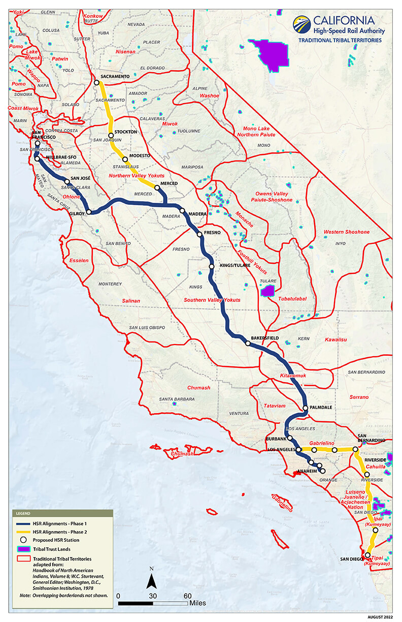
Traditional Tribal Territories Map
The map below illustrates traditional tribal territories and Tribal Trust Lands in California in the vicinity of the California High-Speed Rail alignment. Tribal Trust Lands include reservations or Rancherias, and borders are determined by treaty or other agreement between the tribe and the Federal government. Traditional tribal territories are determined by tribes and reflect ancestral, ethnohistorical, linguistic, and contemporary ties to a geographic area. The traditional tribal territory boundaries illustrated in this map are adapted from those reported in Handbook of North American Indians, Vol. 8; W.C. Sturtevant, General Editor; Washington D.C., Smithsonian Institution, 1978. Traditional tribal territory boundaries are approximations only and overlapping borderlands between Nations are not shown. Download Tribal Territories map.
Traditional Tribal Territories Listing
- Cahuilla
- Chumash
- Coast Miwok
- Esselen
- Foothill Yokuts
- Gabrielino
- Ipai (Kumeyaay)
- Kawaiisu
- Kitanemuk
- Konkow
- Lake Miwok
- Luiseno Juaneño/Acjachemen Nation
- Miwok
- Monache
- Mono Lake Northern Paiute
- Nisenan
- Northern Valley Yokuts
- Ohlone
- Owens Valley Paiute-Shoshone
- Patwin
- Pomo
- Salinan
- Serrano
- Southern Valley Yokuts
- Tataviam
- Tipai (Kumeyaay)
- Tubatulabal
- Wappo
- Washoe
- Western Shoshone
- Yuki


